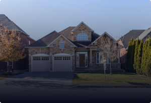
Located in Burbank servicing Burbank, Glendale, Sherman Oaks and surrounding areas
Years of Experience
0+
Projects Completed
0+
Client Satisfaction Rate
0+
Family Owned
Free Consultation Available
Certified & Licensed Professional
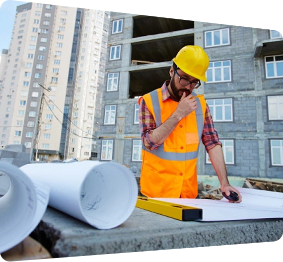
Builder's Pathway Inc.
Builder’s Pathway Inc. is your trusted local general contracting company, offering complete solutions from design and drafting to new construction, remodeling, and renovations. With a strong client base across both residential and commercial sectors, we’re recognized for our reliability, professionalism, and commitment to exceptional workmanship.
Whether you’re planning a new build or upgrading an existing space, our comprehensive suite of services is tailored to your needs. Count on us for diversified solutions, transparent communication, and quality that stands the test of time.
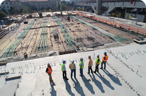
Featured Projects
Skyskuy Tower 4
Renovation & Architecture
Lorem ipsum dolor sit amet consectetur adipiscing eli mattis sit phasellus molli…
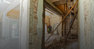
Skyskuy Tower 3
Renovation & Architecture
Lorem ipsum dolor sit amet consectetur adipiscing eli mattis sit phasellus molli…
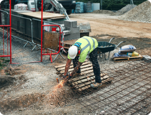
Skyskuy Tower 2
Renovation & Architecture
Lorem ipsum dolor sit amet consectetur adipiscing eli mattis sit phasellus molli…
Skyskuy Tower
Renovation & Architecture
Lorem ipsum dolor sit amet consectetur adipiscing eli mattis sit phasellus molli…
×
Our Services
Explore our full range of residential and commercial solutions.
From renovations to new construction, we offer complete solutions backed by quality craftsmanship and dependable service. Whether it’s a home upgrade, a commercial improvement, or a start-to-finish build, our licensed team delivers results you can trust.
With decades of combined experience, our team brings innovative thinking and proven expertise to every project.
2
Clear Communication
We keep you informed at every phase, no jargon, no confusion, just clear guidance and updates.
3
Trustworthy & Reliable
We honor commitments, follow structured timelines, and complete every project according to your contract and budget.
4
Safety First
We maintain strict safety standards to protect your property, our crew, and your investment.
5
Problem-Solving Expertise
Unexpected challenges happen , our team navigates them efficiently to keep your project moving forward.
6
Clean & Respectful Workplace
We maintain a clean, organized worksite and treat your home or business with the highest respect.
What Our Clients Say
I am very satisfied with the services. Their team is professional and efficient and completed our project on time and within budget. Excellent craftsmanship - highly recommended."
Professional, responsive, and truly skilled at what they do. They transformed our space exactly as we envisioned and kept us informed throughout the entire process. We highly recommend their services.
They exceeded our expectations in every way. From planning to execution, everything was handled with precision and care. The project was completed on schedule, and the final result speaks for itself.
The entire renovation process was seamless from start to finish. The team was transparent, reliable, and delivered outstanding results. Our home looks incredible, and we couldn’t be happier with the quality of work.
FAQs
To serve you better, Builder’s Pathway Inc.’s experts have put together the answers to some of the questions we’re asked most frequently.
What services does Builder’s Pathway Inc. provide?
We offer complete general contracting services, including new construction, remodeling, renovations, additions, design and drafting, project management, and both residential and commercial building solutions.
Are you a licensed and insured general contractor?
Yes. Builder’s Pathway Inc. is fully licensed and insured, ensuring every project meets industry standards and provides clients with complete peace of mind.
Do you handle both residential and commercial projects?
Absolutely. We work with homeowners, business owners, and property developers, offering professional construction and remodeling services for spaces of all types and sizes.
Can you manage the entire project from start to finish?
Yes. We offer full-service project management, from initial concept and drafting to construction, finishing, and final walkthrough, ensuring a smooth and efficient process.
Do you offer free consultations or estimates?
Yes. We provide free consultations where we discuss your project, timeline, budget, and goals. You’ll receive a clear, transparent estimate with no hidden fees.
How long does a renovation or construction project take?
Project timelines vary depending on scope, materials, and design complexity. During the consultation, we provide a realistic schedule and keep you updated throughout the entire process.
Can you help with design and drafting?
Yes. Our in-house design and drafting team can create detailed plans tailored to your vision, functional needs, and budget.
Do you work with subcontractors?
We work with trusted, vetted professionals when needed, ensuring every part of your project meets our high standards of quality and craftsmanship.
What makes Builder’s Pathway Inc. different from other contractors?
We prioritize transparency, communication, quality craftsmanship, and on-time delivery. Our clients value our reliability, clean work practices, and end-to-end service model.
How do I get started with my project?
Simply contact us to schedule a free consultation. We’ll discuss your goals, inspect the space if needed, and walk you through the next steps to begin your construction or remodeling project.
Contact Us
We’re ready to discuss your project and provide a detailed estimate. Fill out the form below, and our team will get back to you promptly.